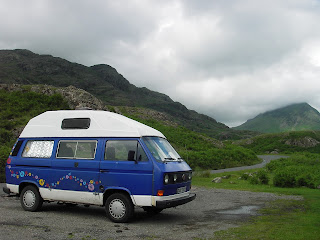
Saturday
23rd June 2012
Woke
up at 04:00. The plan was to leave early to beat the traffic. After a
quick breakfast and some final packing we were on our way before 05:00.
The
weather was dry but windy most of the way there. The traffic was
light and BOXY cruised along happily at 60mph. On our second service
station stop the right rear CV joint clunked a couple of times. I
gave it a waggle to move the grease about and it was quiet for the
rest of the day.
We
arrived in Cumbria before 12:00 and the rain started to fall
properly. We had planned to camp at Baysbrown just outside Ambleside.
We called in at the site but there was no-one around and only two
tents and a motor-home near the farmhouse. We drove back into
Ambleside for an amble in the rain. We mooched around the shops and
had fish & chips in the Old Smithey. We headed back to Baysbrown
and this time Dawn found someone to talk to. It turned out that they
thought the road in was likely to flood during the night meaning
anyone camping there would be trapped in the morning. We decided to
relocate to higher ground. One of the other places we planned to stay
at was over near Derwent Water, Castlerigg Farm. It was only 15
miles from Ambleside so we headed north through the rain for higher
ground. The scenery on the route was a bit like driving to Milford
Sound in New Zealand in places if not quite as big. The rain &
mist bit their best to spoil the views but Dawn managed to grab some
“road-trip” photos anyway.

We
splashed out on a pitch with hook-up so we can watch TV in the
evenings if the weather stays damp for the next couple of days.
The
campsite has its own water supply which is the colour of tea and so a
bit off-putting when cleaning your teeth. Didn't taste of anything
though and that was the main thing. There's also phone and TV
reception (though a bit blippy), always a plus. The site's own cafe
does breakfasts and evening meals so maybe we should stay here for
the duration.
Sunday
Lie
in until nine and then a cheat's breakfast from the camp-site cafe of
two Cumberland sausage baps. Yum! And no washing up. It was raining
on and off so we didn't set off until eleven after waiting for a gap.
The footpath started on the road outside the campsite and led around
in a big circle across some muddy sheep & cow filled fields. It
took about an hour to get to Castlerigg Stone Circle where we had fun
trying to take pictures without any other tourist in. The stones vary
from knee high to shoulder height so bigger stones than any on
Dartmoor.
Then
off down the hill and into Keswick pausing to try a photograph a
rooster on a wall that didn't want to pose for us. Lunch was in a
traditional tea room; all thick carpets, waitress service and us in
our only slightly muddy walking boots and full on water proofs. I
think they must be used to it. Dan had the world famous plum bread
sandwich with cheese and chutney. It tastes a bit like raisin bread.
I had Keswick rarebit.
Waterproofs
on again and we headed through the town towards the lakeside for an
amble around. We walked to the sixth most breathtaking view in
Britain (or something like that) and yes it was pretty. There was
still lots of cloud around and intermittent rain. The lake was really
full and the gentler parts of the shoreline had flooded so we
couldn't do our planned route. We could see the gate we should have
gone through (and into a wood) but it was under about 2 feet of
water. We ended up going a shorter route back to the camp-site
(yea!). It stopped raining and we found a fantastic view point
looking back across the lake towards the mountains. Then after wading
through a minimally flooded footpath (walking boots proved to be
waterproof thank goodness) it was uphill all the way back to the
camp-site and the sun came out at long last so we could dry off all
our gear. We even managed to soak up a bit of sunshine and watch the
hedgerow birdies have a communal bath in a muddy puddle.
Monday
 Upped
sticks from Castlerigg Campsite and headed off to Cats Bells for a
walk (known hereafter as Cats Balls). There was no actual car-park so
we had to park further on than we intended on the road that runs
alongside the Fell.
Upped
sticks from Castlerigg Campsite and headed off to Cats Bells for a
walk (known hereafter as Cats Balls). There was no actual car-park so
we had to park further on than we intended on the road that runs
alongside the Fell.
We
decide to take a 'shortcut' to the crest of the ridge. The shortcut
was steep. Really, really steep. No climbing gear was needed so I
guess steepness is relative. But we were rewarded with stunning views
across the lake back to Keswick and then over the other side of the
ridge down into Newlands Valley. There was still a way to go before
the top so we rested up and got overtaken by about 50 kamikaze school
kids powered by duracell batteries. Fortunately they came thundering
back down from the top again before we made it up to the top.
Fantastic views. Oh for a hang-glider and the nerve to run and jump.
The
way we'd picked to come back down was not quite as steep as the climb
up. The path was paved with stones which made the going easier but
you still ended up with jelly legs with all the effort. It just kept
going down and down. Next, we headed off to Ullswater to look at
Hellvelyn. The Catsballs (yes, its been renamed) being a practice run
but Dawn had used up all her energy climbing it.
 The
next camp-site we planned to visit was Gillside Farm, about 15 miles
from Keswick. The trusty satnav led the way along some surprisingly
small roads to Glenridding. The camp-site was less than a mile out of
the town on the route to Hellvelyn. Our pitch was a gravel
hard-standing with a hook-up. Unfortunately the lack of WiFi and TV
reception meant all we could use it for was charging up phones,
netbook and other assorted gadgets. We had a bit of a snooze to
recover from Catsbells and then Dawn cooked up some stew for tea.
After we walked down to the village and got a few supplies at the
village shop. Cumberland sausage, cheese, beer and some cakes. We had
a quick look around the village but there wasn't much to see and most
of the lake front seemed to be private land. Back at the camp-site we
sampled the beer and cheese and lit some citronella candles to fend
off the growing number of midges. The weather for tomorrow sounds
promising but the attempt on Hellvelyn's summit may be canceled due
to lack of energy and shin flints. We'll see how we feel after an
early night.
The
next camp-site we planned to visit was Gillside Farm, about 15 miles
from Keswick. The trusty satnav led the way along some surprisingly
small roads to Glenridding. The camp-site was less than a mile out of
the town on the route to Hellvelyn. Our pitch was a gravel
hard-standing with a hook-up. Unfortunately the lack of WiFi and TV
reception meant all we could use it for was charging up phones,
netbook and other assorted gadgets. We had a bit of a snooze to
recover from Catsbells and then Dawn cooked up some stew for tea.
After we walked down to the village and got a few supplies at the
village shop. Cumberland sausage, cheese, beer and some cakes. We had
a quick look around the village but there wasn't much to see and most
of the lake front seemed to be private land. Back at the camp-site we
sampled the beer and cheese and lit some citronella candles to fend
off the growing number of midges. The weather for tomorrow sounds
promising but the attempt on Hellvelyn's summit may be canceled due
to lack of energy and shin flints. We'll see how we feel after an
early night.
Tuesday
26th
 The
weather first thing was bright, but still over-cast. On balance after
yesterday's “walk” we decided to have an easy day and not climb
any mountains. Dawn cooked up a mini fried breakfast of egg plus
Cumberland sausages x2. We quickly chucked everything but the picnic
table back in the camper. We left that as our territory marker to
stop another camper nicking our pitch while we were away. About 4-5
miles back down the lake shore was the car-park to Aria Force
waterfall. The car-park is free to NT members so it was silly not to
take a look. We walked up the circular path to the bridge that
crosses the falls at the top and then followed it down to where the
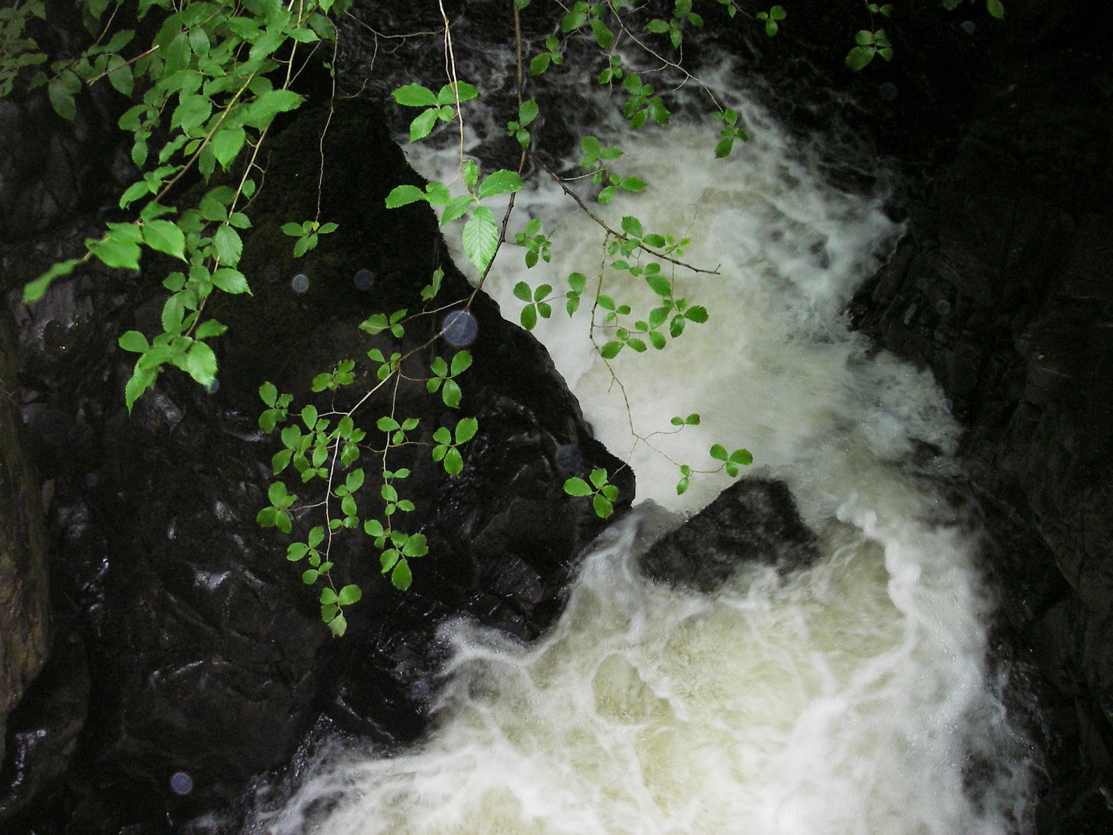
second bridge crosses at the bottom. It was an impressive waterfall
especially after all the rain recently reminiscent of Lydford Gorge
with a dark rock chasm and white frothy water. We stopped off at the
tea shop for lunch, cream tea for me & chocolate cake for Dawn.
Next we walked down to the lake side just in time for a convoy of
swans to cruise past in a photogenic way.
The
weather first thing was bright, but still over-cast. On balance after
yesterday's “walk” we decided to have an easy day and not climb
any mountains. Dawn cooked up a mini fried breakfast of egg plus
Cumberland sausages x2. We quickly chucked everything but the picnic
table back in the camper. We left that as our territory marker to
stop another camper nicking our pitch while we were away. About 4-5
miles back down the lake shore was the car-park to Aria Force
waterfall. The car-park is free to NT members so it was silly not to
take a look. We walked up the circular path to the bridge that
crosses the falls at the top and then followed it down to where the
second bridge crosses at the bottom. It was an impressive waterfall
especially after all the rain recently reminiscent of Lydford Gorge
with a dark rock chasm and white frothy water. We stopped off at the
tea shop for lunch, cream tea for me & chocolate cake for Dawn.
Next we walked down to the lake side just in time for a convoy of
swans to cruise past in a photogenic way.

Having exhausted the sights
of Aria Force we drove down the lake side for a few more miles until
we reached Pooley Bridge. Dawn checked out the shops and made a
couple of phone calls. We haven't had a mobile signal since arriving
here so it was a bit of a surprise that both Orange & 3 worked.
Just after we arrived it started raining but we toughed it out, took
some photos before setting off down the other side of the lake. From
the map it looked like there were a couple of small villages but in
reality they turned out to be just a few houses, no shops, pubs or
signs of live. The road eventually started to head up into the hills
and it seemed daft to break the camper driving up a mountain so we
turned around & headed back. The trouble with Ullswater is most
of the lake shore is privately owned so you can't walk around it, or
even get close to it. We did find a lay-by on the way back that was
right on the water's edge. We stopped a noodle lunch & a cup of
tea and watched the steam launches touring up and down. The weather
had by now turned to a persistent drizzle so we drove back to
Gillside. We faffed about for an hour or so until after six and then
walked over to the Traveller's Rest. The tiny lounge was full so we
sat in the “lean to”. I ordered the Traveller's Special burger:
starting from the bottom: bun, salad, pineapple, beetroot, burger,
bacon, fried egg, bun. The side dish option was either chips (nothing
odd there) or baked potato (surely a dish in its own right?) Needless
to say it was quite filling especially washed down with a pint of
Hellvelyn Gold golden bitter. Dawn just went for a straight chicken
burger that was a sensible size and half of the same.
Before
turning in for the night we took a short walk up the track that leads
to Hellvelyn the drizzle was a bit lighter but it was still
impossible to see where the track up the mountain actually went?
Maybe out for next week? There is a “shorter” route up from the
other side but we'll need to see how close we can camp to the start
point. The weather is supposed to turn worse for the next few days so
we're thinking of head up to Hadrian's Wall to see if the weather
gets better further North
Wednesday
27th
We
woke up, had toast for brekkie and were out of the camp-site just
after 9:30., a record. By the time we got on the M6 the rain was
hammering down and the visibility was awful. We stayed on the
motorway until we turned off at Gretna. We had a walk around the
shops which had been set-up to cater for the coach loads of tourists.
Overpriced mini bottles of whiskey, CD's by a band called the Red Hot
Chilli Pipers and Tam O'Shanters with red wigs attached was the order
of the day. Needless to say we resisted the urge to part with any
cash and took the A-road south towards Hadrian's Wall. Our first stop
was Vindolanda. The rain turned to drizzle making walking around the
site a bit more bearable. The museum part of the site was interesting
particularly the written documents that had survived. The gift shop
was less tacky than Gretna's but we still resisted the shopping urge,
although Dawn did fondle a plastic Roman soldier's helmet wondering
whether buying that and a sword was a wise choice to buy her nephew
who has two older annoying sisters. The sword was plastic too by the
way.
The
camp-site we'd planned to stay in wasn't far away so we headed there
next. Our pitch turned out to be a squeeze in between a Bay camper
and a tent. The site owner directed us into the spot mainly because
he was worried about BOXY marking his sodden grass. After we'd parked
& prepped it was still only 4 o'clock. It was still drizzling but
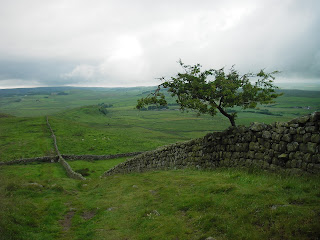
we decided to walk up the nearest section of the wall. The first ¼
mile was along a country lane and the next across a rough boggy
field. The field's occupants, some cows & possibly a bull,
watched us from a distance probably waiting for us to get stuck in
the mud before moving in for the kill. It took about half an hour to
get to the wall itself which climbed steeply up to a high ridge
overlooking the countryside. Dawn took some photos as we walked along
the ridge for about a mile. We followed it along for about an hour
before taking another footpath back to the road that runs parallel
with the wall. We stayed on the tarmac all the way back to the
camp-site because the short-cut footpaths all seem a bit wet or
surrounded by livestock.
The weirdest part of the walk happened just
before we got back to the camp-site. The lane back to the site was
lined with a dry stone wall with a single strand of barbed wire
strung above it. As we walked along I noticed something hanging on
the wire? When I looked more closely I realised it was a dead mole
hung by its head from a barb on the wire. Then I saw that there were
ex-moles hung all along a section on the wire. There must have been
over thirty? It was all a bit “wickerman” I think if we'd been
the only campers on the site we'd be driving back into Devon about by
now.
Back
at BOXY Dawn cooked her sausage & pasta surprise (no surprise
anymore but it still tastes good) followed by biscuits &
chocolate for afters. The weather stayed decidedly damp but on the
plus side we've got TV reception (weather looks to be wet again
tomorrow) so we finished off the day in front of the box with a
bottle of wine and cheese and biscuits.
Thursday
28th

Today
was going to be our walk along Hadrian's Wall. The weather was the
now normal damp drizzle so we dressed in our waterproofs from the
start. The first couple of miles were along the B6318 (Military
Road). It was obviously a Roman road as it ran straight for 3 or 4
miles, but it did dip up and down a bit. I was carrying the rucksack
so Dawn set her usual “near running” pace. We reached the
information centre at Once Brewed in about 30 minutes, not bad for
nearly 2 miles. The lady in the info centre suggested we used a
track (called Military Way) that ran parallel to the wall instead of
risking life & limb on the B-road. The track lead straight to
Sycamore Gap, famous for being used in Robin Hood Prince of Thieves. This change of route meant that Dawn's planned circular turned into a
straight walk away from the camp-site. We carried on along the wall
taking snaps along the way until we reached where Dawn's route would
have started. About one and half miles further on was the National
Trust run site of Housesteads. We decided that if we carried on to
Housesteads we could have some food in the cafe and then catch a bus
back to the camp-site if we were tired. The extra 1.5 miles was quite
“undulating” as the guide book said they would be, so being
“tired” was a given. Part of the way actually ran along top of
the wall, something discouraged along the rest of the wall. While we
were looking around the thunder gradually rumbled closer but the rain
stayed away. Once we'd looked around the museum and the ruins of the
fort we headed down the valley to the cafe. A few minutes after we
sat down for a tea / coffee the heavens opened. We sat in the cafe
sipping our drinks and watching the progressively wetter people
walking in. After about 40 minutes we found that the courtyard
outside the cafe was underwater and we had to escape by climbing a
fence behind the building and avoiding the deepest water. We stood in
the car park in the pouring rain in our mainly effective waterproofs
chatting to a wet American in a pac-a-mac and his Russian sounding
wife & daughter who had waded out of the cafe with plastic bags
over their slip on shoes. On the bus we stood at the front to stop
getting the seats wet. The windscreen heater wasn't working so the
driver was having trouble seeing through the misted up glass. I
pulled a mini-towel out of my ruck-sack and lent it to the driver so
he could clear the windows enough to get out of the car-park. The
five mile bus journey was a bit like being on the bridge of the boat
in Perfect Storm. Every dip on the B-road was about a foot deep in
water and the bus managed to spray most of it into the fields at the
side of the road. The bus driver dropped us between stops so we'd
have a shorter walk back to the camp-site, and by then the rain had
mostly stopped. Back at the camp the rain actually stopped and the
sun actually came out! We quickly improvised some drying-horses and
managed to get most of the waterproofs & towel etc. dry. We
probably should have made more of the dry weather by going for an
evening stroll but we decided to drink beer & eat biscuits
instead.
Friday
29th
First
thing the weather looked brighter, but the wind had turned blustery
and while we were packing to leave there was a light shower. We got
packed up before 10 and followed the sat-nav to a NT place a few miles
away. It turned out to be a gorge and wooded walk which didn't float
our boat after yesterday's hike. We retraced our route and went to
Haltwhistle. (allegedly the geographical centre of the UK). We got
some groceries at the Co-op, some chicken & pies from a butchers
before finding a cafe for breakfast. We managed to fit it all in,
before the one hour's free parking expired. We decided to head for
the coast and avoid driving down the M6 in the high winds. The route
took us out through Carlisle and then through numerous small
villages. We stopped in Cockermouth to eat the pies we bought earlier
and have a look around the high street. Next we drove to Seascale
where we parked in the beach side car park and had a quick, wind
blown walk on the sands. The sea was a long way out and just looked
brown and mad in the distance. We carried on down the coast for a few
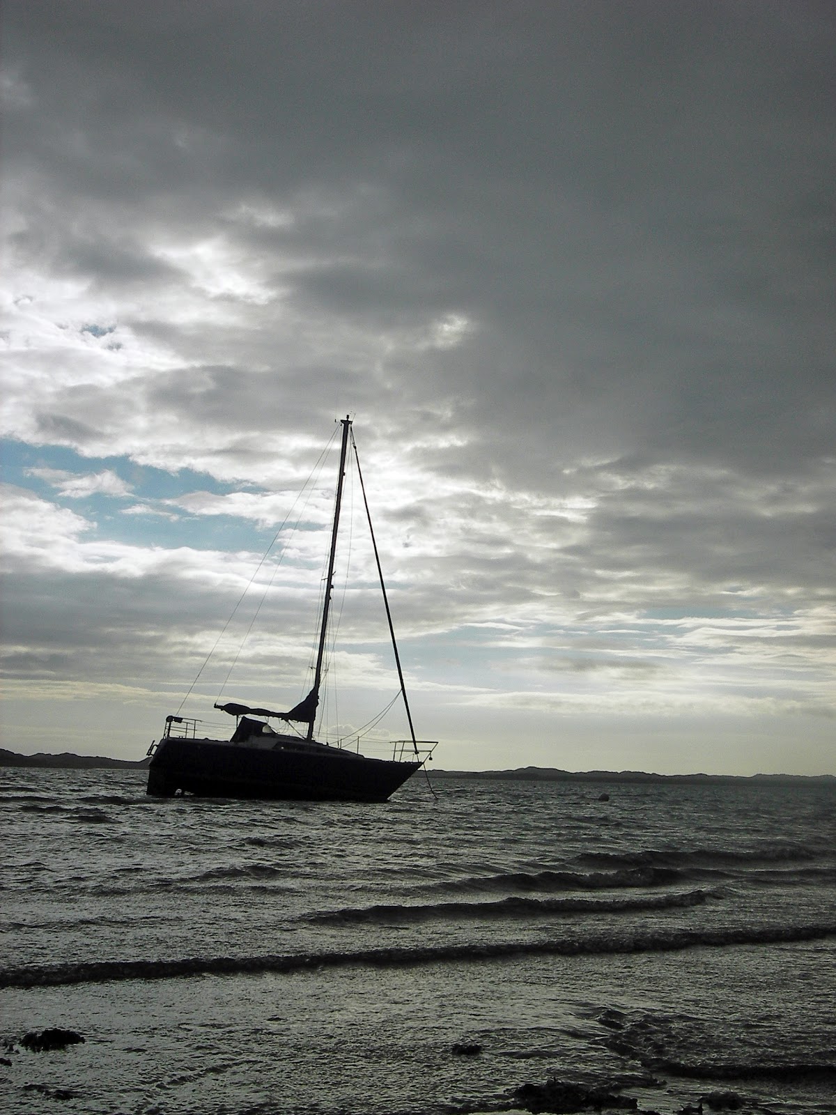
more miles until we reached Ravensglass. The first camp-site we saw
was a Camping & Caravan Club one.

As we were only planning on
stopping for one night we decided to try it. We ended up on a gravel
hard-standing behind the staff's bungalow and were charged £24 for
the privilege. On the plus side there was free wifi, Dawn though the
showers were excellent and really given the weather the actual pitch
isn't too important. Dawn cooked up a Chinese using the chicken from
Haltwhistle and then we went for a walk. The site is about 5 minutes
walk from Ravensglass not that there's much to see in the village. We
walked along the shore, took some photos, walked through the woods to
the Roman bath-house and that pretty much ticked all of Ravensglass'
boxes. We couldn't try the minature railway because that had already
closed for the day but we probably wouldn't have anyway. Back at BOXY
we made the best use free wifi and ran the netbook on the leisure
battery (no hook-up). So far the red warning light hasn't come on
much to my surprise.
Saturday
30th
We
woke up after 9 so decided to skip having breakfast on the site so
just packed up and went. We drove into the “centre” of
Ravensglass and parked up with a view of the water. We had a muesli,
blueberries & banana with yoghurt, probably the most healthy
thing we've eaten since we've been away. Then it was off again down
the road to Haverigg. On our right the skies were bright over the
coast but to the left the top of the mountains were still covered in
dark misty clouds. We arrived at Beryl's around 11 and found her
cooking lasagne for our lunch. We had planned to take her out to
lunch but lasagne followed by sticky toffee pudding turned out to be
a better idea after all. We chatted until after 2 and then headed
back along the road to Ravensglass before turning off to Wasdale
Head. On the way we stopped by the lake side to take a few photos.
The sun managed to find a few gaps in the clouds, just enough to make
the landscape more photogenic.
When we got to the NT campsite at the
head of the valley we found out it didn't open until 17:00, and that
was over an hour away. We drove back to the spot on the side of the
lake we'd stopped at first to kill a bit of time in a more scenic
location. We studied the OS map and tried to work out a walk to try
tomorrow. Dawn wants to walk along the edge of the lake across the
scree slopes and I want to climb up to the top of the ridge. The
weather will be the deciding factor in the end, it's been dry all day
but the wind is strong & cold, tomorrow should be the same. We
drove back to the site and paid for two nights with the luxury of
hook-up so we can charge up our gadgets. Tonight it was my turn to
make tea so we had baked beans & mini sausages on toast followed
by ginger nut biscuits. The bar had been set high by our lunch but I
think I matched it? After tea we took a walk up the road to Wasdale
Head. There is a pub there called the Wasdale Head Inn famed in
British climbing circles according to one of our guide books. The
views along the road to the pub are stunning especially when the sun
put in an appearance. For a pub at the end of a dead-end road it was
surprisingly busy. We ordered a pint & a half of Scafell Gold &
sat outside by the river. The midges were just starting to appear but
we survived relatively un-bitten. We only stopped for the one then
headed back to the camp-site. The section for camper vans is on the
edge of the site in a separate little enclosure with pitches for four
vans. This means the toilets etc. are about a 10 minute walk away
along two lanes & across a field of tents. It's not a problem now
21:55 in daylight, but any calls of nature in the middle of the night
could be an adventure? Ho hum, we'll worry about that later, time for
bed now.
Sunday
1st July
Woke
to the sound of rain on Boxy's roof. The weather forecast that had
promised sunny periods and fluffy clouds had clearly got it wrong. On
the walk to the distant toilets it was obvious that the rain wasn't
going to stop anytime soon. The peaks that surround the site were all
totally shrouded in cloud. I checked the “new” forecast that had
been posted on the reception notice board and the brighter weather
wasn't expected until early afternoon. We decided to hide in the van
have an extended breakfast (muesli followed by chorizo &
scrambled eggs) and wait for the rain to die down. Eventually we set
out after 11 wearing our waterproofs. The first section of the route
crossed through some fields and a couple of streams before hugging
the side of the lake. Eventually you reach a sign that says “scree
path, take care in wet conditions, allow extra time etc etc.” This
doesn't really prepare you for the next 2-3 miles. At first there's a
rough rocky path, then there are scree slopes and more rocky path,
and finally there are just boulder fields of slippery, loose rocks
big enough to squash you like a fly.

The first couple of scree slopes
are quite easy going with a path worn by thousands of other feet. The
path is narrow and one slip would see you bouncing down into the lake
between 3 and 20 metres below depending on which section you are on,
but it is a path. The last mile though the boulders it far more
sketchy. There is no visible path and most of the rocks you are
stepping on have no visible means of support. It a bit like a giant
version of Kerplunk with rocks instead of sticks. You are about four
metres above the lake and above you are thousands of tonnes of rocks
stretching up for a few hundred metres. Now normally gravity would
say the rocks are going in the lake and no puny human is going to
stop them, but something is keeping all the rocks gently in place
like a house of cards. Every so often as you hop from rock to rock
one gets loose and clatters a few feet closer to the lake and you
freeze waiting for the clatter to turn into nature shouting
“Kerplunk”. We stopped for some sandwiches half way across the
last section when we reached a large rock platform on the edge of the
water. Eventually we crossed the last stretch of boulders and got
back onto the grassy path at the end of the lake. We cut through a
wood into the grounds of a YHA so Dawn could answer a call of nature
without having to hide in the bushes. The next three & half miles
were along the road on the other side of the lake. We stopped to chat
with the owner of a red camper type van who was wild camping in a
lay-by. He was a painter who had been in the area for a week. He had
watched our progress down the scree path and watched to know if he
would be able to get along it with his painting gear. We suggested he
drove to the YHA and walk along the “easy” path to the boulders
and see what he thought. At least that way he would have an easy
retreat if he didn't fancy it. The last couple of miles back to the
camp seemed endless. The GPS said it was 7.6 miles but it wasn't on
all the time, it certainly felt like a lot more. We were too
knackered to walk the ½ mile to the pub for tea, so had a tinned
curry, a bottle of red and a relatively early night.
Monday
2nd
This
time the weather forecast was spot on and it was raining heavily &
pessistantly. We drove across to the reception area to fill up Boxy's
water tank and in the haste to get going left the waste water
container behind. (Not that we noticed until that evening and far too
late to go back for it). Before starting our journey proper Dawn
wanted to visit a gift shop she used to get taken to when she was a
child. We knew we had driven passed it on Saturday we just couldn't
remember exactly where. Needless to say we explored quite a few
miles of Cumbria before we found it. This did mean that we felt
obligated to buy something having traveled such a “special”
route to reach it. We left carrying Cumberland Sauce, Rum Butter,
Kendal Mint Cake and Cumberland sausage from the shop next door. We
had decided not to take the short-cut over Hardknott Pass but
detoured through Ulpha. This route still took us over the high ground
and was 1st gear for a lot of the way. There were supposed
to be view points along the road but everything was obscured by the
low cloud and rain. We carried on along the A536 which shouldn't be
classed as an A-road in the traditional sense. There certainly
weren't any dual-carriageway sections. We reached Coniston and found
a hour max stay parking spot at the end of the high Street. That gave
us enough time for lunch of rarebit with a huge pot of tea, and for
Dawn to buy some replacement waterproof trousers. Our planned
camp-site of Low Wray was only 7 miles away so we headed there next.
The site is a real mix of options. We drove past the pitches
over-looking a field of sheep, past the Yurts, Tipis, Camping Pods,
old fashioned traditional Gypsy Caravans (minus horse) and picked a
pitch by a river in a wood. If it wasn't for the rain and mud it
would have been one of the best places we've ever camped. The site
has even got pitches on the lake shore. In better weather it must be
really busy. Within a few minutes of stopping a huge swan walked up
from the river & stood beside Boxy waiting for food. I decided to
give him the crusts from our loaf of bread.
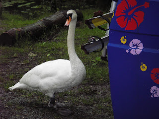
He would have quite
happily snatched it out of my hands and then probably eaten me as
well. I had to throw pieces of bread further and further away just to
get him to keep his distance. By the time I was throwing bread in the
river another swan and three ducks had joined in. Luckily once the
assorted birds had filled up on bread they left us alone. After we'd
cleared the area of feathered friends we went for a stroll in the
rain. We had planned to walk towards Ambleside but due to a sign-post
reading error we ended up walking in sort of the wrong direction.
Dawn had brought a map with her but what she though was end of the
lake was a completely different tarn. If we'd have carried on through
the fields we would have eventually reached a road that looped back
to the camp-site but Ambleside was still in the opposite direction.
We decided to re-trace our muddy footsteps and go back and make tea.
Dawn cooked up a huge Cumberland sausage so we could try out the
Cumberland Sauce we'd bought this morning. It was smashing!
Tuesday 3rd
Finally the rain got and we headed home.